Allow enough time
Set aside at least two to three hours. Road conditions, parking, route-finding, photography and careful travel over uneven ground can all extend the visit.

“Sea of rocks in German”
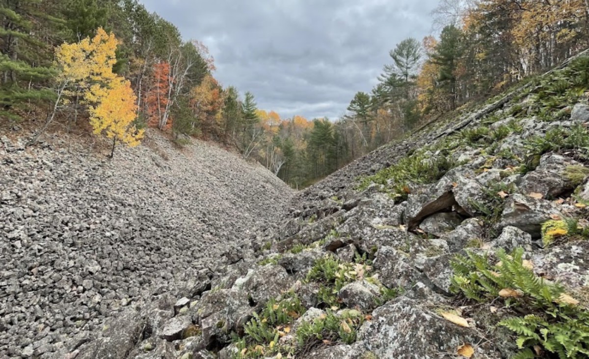
Step carefully into another age.
An ancient sea of quartzite, shaped by glaciers, frost and time—and hidden in the quiet forest between Bruce and Weyerhaeuser.
Not simply a hike
In the western folds of Rusk County, the forest opens onto something unexpected: small valleys filled with broken quartzite, pale lichens and cool air rising from spaces deep within the rock.
Blue Hills Felsenmeer is a 53-acre State Natural Area within the Rusk County Forest. It is remote, primitive and wonderfully undeveloped. There are no rides, railings or visitor center—just an extraordinary geological story written directly across the land.
01
Ice, stone & time
During the region’s glacial past, the Blue Hills endured severe tundra conditions. Water entered cracks in the brittle quartzite. When it froze, it expanded. Repeated freezing and thawing fractured the stone through a process called frost wedging, helping form slopes and valleys of angular rock.
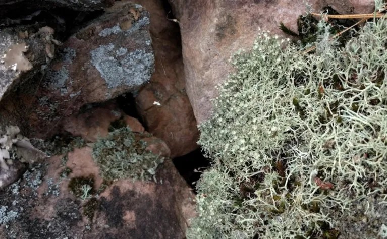
Some slopes remain remarkably stable. Others end in ridges of accumulated stone—known as talus moraine—that can reach roughly six feet high. Cold air still moves out from deep openings in portions of the slopes, supporting cool microenvironments, diverse lichens and species associated with boreal and tundra conditions.
This is not scenery placed around a trail. The geology is the destination.
What it feels like
The approach leads through working forest country, where pavement becomes gravel and the noise of town falls away. On foot, the route continues along a gated logging road toward the natural area.
Then the ordinary forest floor gives way to angular quartzite. Lichens soften the stone visually even as the ground becomes more demanding. Slow down. Notice the temperature near openings in the rocks. Study the shape of the valley. Imagine this hillside exposed to tundra cold before the modern forest existed.
The best visit is not the fastest one. Leave enough time to move carefully, observe closely and return before daylight or weather becomes a problem.
 02
Before you turn onto the gravel
Blue Hills Felsenmeer is not a developed park. A little preparation is what turns a remote visit into an unforgettable day.
Do not expect restrooms, drinking water, picnic facilities, paved paths or reliable cellular service. Download maps before leaving.
Set aside at least two to three hours. Road conditions, parking, route-finding, photography and careful travel over uneven ground can all extend the visit.
Wear sturdy boots with traction and ankle support. Wet lichen, loose stone, fallen leaves, ice and snow can make footing unpredictable.
Bring an offline map, charged phone and backup navigation such as a paper map or compass. Tell someone your route and return time.
Official approach
From the intersection of Old 14 Road and County Highway W, travel north on County W for 2.3 miles to a gravel turnoff just after the road begins to curve.
Approaching from the north, travel south from the County Highway O and County Highway F intersection for 2.7 miles. Higher-clearance vehicles may be able to continue down the gravel road to park. The hiking approach begins west along the gated logging road.
A shorter approach exists from the end of Slack Road, north of the curve on County W. Slack Road is usually not plowed in winter.
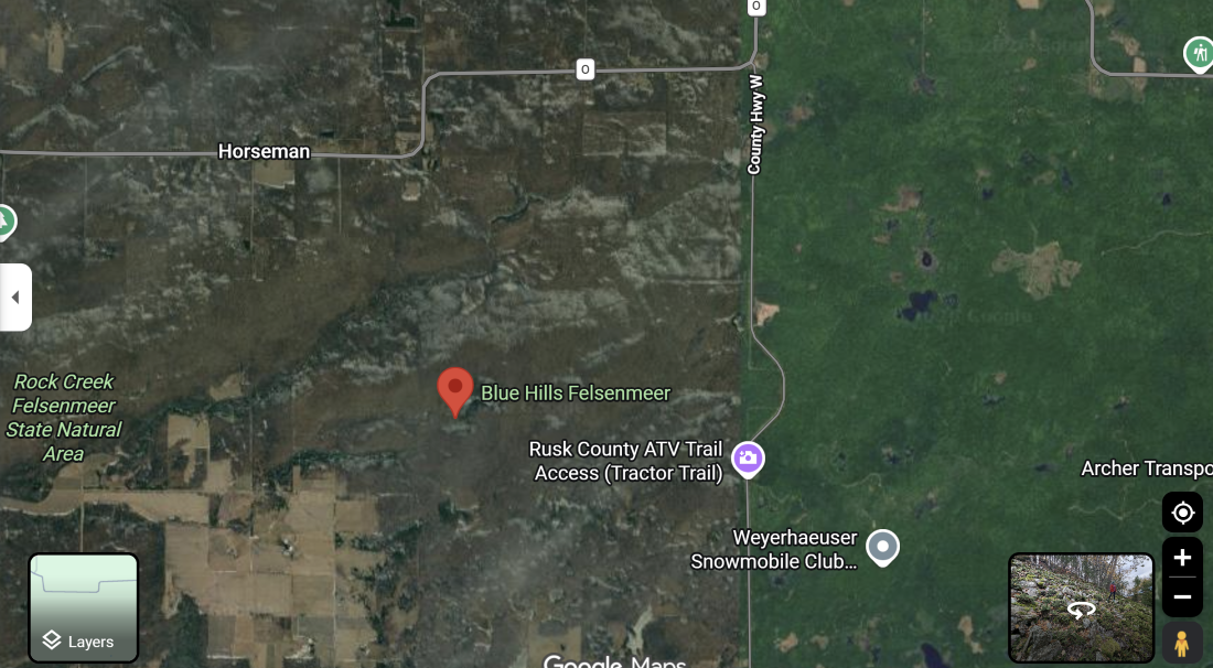 Blue Hills Felsenmeer access Embed an approved map or link to official DNR mapping. Do not rely on an unverified third-party pin.
Stock up before you go
Make Bruce or Weyerhaeuser part of the day. Fill the tank, pick up water and trail food, check for local dining and confirm anything you may need before entering remote forest country.
Plan a pre-hike breakfast, fuel stop or supply run—and return after the outing for a local meal, shopping or community stop.
A useful reference point for western Blue Hills routes and a natural place to find local stops before or after the adventure.
Local-business opportunity: Link these cards to each community page’s dining, shopping, fuel and service listings so visitors can build their stop around current Chamber members.
Four different experiences
Mud, runoff and lingering ice can complicate access. Check county forest vehicle restrictions before traveling.
A practical time to explore. Pack water, insect repellent and tick protection, and allow extra time in dense vegetation.
Gray quartzite beneath brilliant foliage is unforgettable. Fallen leaves hide gaps, and hunting-season visibility matters.
Roads and parking are not plowed. Snow can conceal dangerous openings. Winter travel requires experience and conservative judgment.
03
Tread lightly
What should you do next?
The Felsenmeer may be why you came, but it does not have to be where the adventure ends. Ride deeper into the Blue Hills, follow a quiet forest trail, launch onto one of Rusk County’s waterways, drive beneath a canopy of fall color or make a nearby community part of the experience.
Trade hiking boots for four wheels on a scenic developed ATV route through rugged forest country. The northern trailhead is reached from County Highway F on North Bucks Lake Road, north of Weyerhaeuser. Check current trail openings before loading up.
Plan the ATV ridePut a canoe or kayak on the Chippewa, Flambeau, Jump or Thornapple. Choose from gentle stretches and more demanding water, then match the route to your experience, water conditions and available daylight.
Choose a paddling routeContinue through more than 35 kilometers of non-motorized trails used for hiking and mountain biking, then cross-country skiing and snowshoeing when winter settles over the hills.
Explore the trail systemFollow 13.1 unpaved miles through the Blue Hills on Fire Lane Road and the Perch and Bucks Lake roads. The route connects lakes, campgrounds and trail access beneath a spectacular fall canopy.
Plan the scenic driveTurn a day trip into a Blue Hills getaway. Perch Lake Campground provides access to ATV riding and puts visitors close to lakes, forest roads and the quieter side of western Rusk County.
Explore Perch Lake campingKeep following Wisconsin’s glacial landscape on roughly 12 miles of the Ice Age National Scenic Trail in Rusk County, passing remote lakes, hardwood forest and unusual rock formations.
Find the Rusk County segmentChoose your kind of day
Use these as starting points, then adjust for weather, trail conditions, water levels, daylight and the ability of everyone in your group.
A place worth the preparation
Blue Hills Felsenmeer does not need a gift shop to be unforgettable. Its power comes from what is already here: ancient quartzite broken by frost, valleys holding the breath of a colder age, and lichens slowly painting stone.
Plan more of your Rusk County visit